![]()
 |
![]()
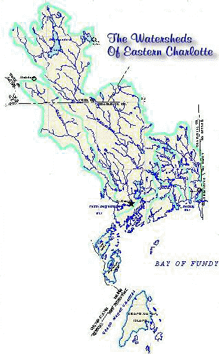
Geographical Information System (GIS) A community mapping program in cooperation with
Fisheries and Oceans - Habitat in 1994 saw the initial development of
resource mapping for ECW. In the past four years this mapping initiative
has become a warehouse of layered thematic data for this site including
such data as soils, forestry, water quality, geology, fisheries, stream
assessments as well as various project data. To date ECW has been able to assist community, small business, local fishermen and various government departments including NB Department of Environment, Municipality, Housing and Culture with their management planning based on onsite GIS data storage. ECW is a Map Sales and aerial
photo outlet maintaining a stock |
![]()